Tracking Tool | Raster Preferences | Caching | Program Paths | Legend
|
|
The tracking tool preferences are used to control the types of information
displayed by the tracking tool. This is the display area at the bottom
of the Main TerraLook Window that shows
information about the location pointed to by the cursor in the window. Coordinate: Possible values are:
Lat/Long Format: Determines the format to display Lat/Long values for the tracking tool. Possible formats are:
Pixel Value: Determines whether the tracker should report the top most raster layers pixel value under the cursor. Note that fetching the pixel value can be expensive for some organizations of raster file, and thus can slow down interactive performance. |
 |
Display Georeferencing:
Determines whether views loaded with a raster image should operate in
georeferenced coordinates for that raster, or in raw pixel/line. A few points
of note:
Overview Sampling: Determines the sampling method to use when downsampling rasters for displays of overview images. Note that the sample method is a property of a raster, and is established at the point the raster is first displayed in a given TerraLook session based on the preferences. Changing this preference will only affect subsequently opened rasters.
Decimation is the default, as it is less computationally expensive and gives more appropriate results when viewing complex phase images. Averaging can give much more viewable results for noisy data such as radar images. However, it makes loading overviews of large images without pre-computed overviews much more expensive because data must always be loaded at full resolution and averaged down to display resolution on the fly, whereas decimated displays often only need to load a small portion of the total available scanlines in order to compute the decimated display. Subpixel Interpolation: Determines how a pixel is displayed close-up.
Autoscaling Method: Determines the method used to scale an image.
|
 |
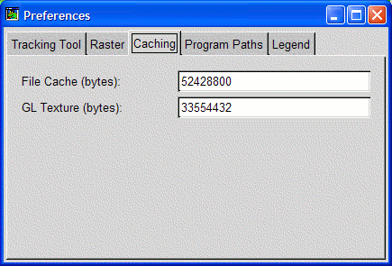
Caching issues are covered in more detail in the
Performance Tuning page. File Cache: Number of bytes of memory available for caching raw raster data from disk. GL Texture: Number of bytes of video or system memory available for caching image texturse.
|
 |
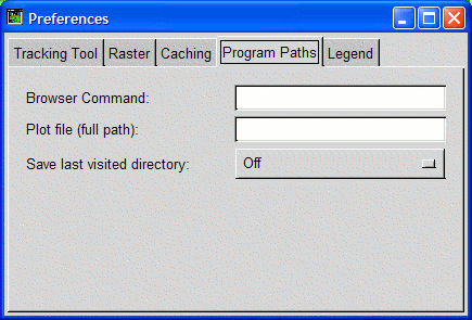
Enter a command to be used to display a web page containing help (such as this one). If the command includes the value "%s" then the name of the file or URL to display will be substituted for the %s. Otherwise it will be appended to the command. By default TerraLook attempts to find one of a few common web browsers. To test a newly entered value, go to the main view window help menu and select a topic, or hit F1 over the preferences panel, after clicking outside the text box. |
 |
Background color, title and label fonts and the size of each category drawn in the legend window can be controlled from this pane. |